NOAA utilizes two types of aircraft in its hurricane operations. The first is the high-altitude Gulfstream G-IVSP (SP stands for special performance), shown at the right, which flies in the

environment surrounding the storm or in which the storm is forecast to move. The track shown to the left was flown around Hurricane Dean on 20 August 2007. Flying between 41,000 and 45,000 ft., the aircraft serves as a platform from which light-weight GPS dropsondes are launched at locations indicated by the numbers in the picture. These sondes, which descend to the surface with a fall speed of about 3,000 ft/min. while steadied by a small drogue chute, radios temperature, humidity, pressure and sonde position data back to the aircraft twice a second. Wind speed and direction are computed from the GPS position changes. These data are processed onboard the aircraft and then transmitted via satellite to NOAA for inclusion in the hurricane forecast model runs. An improvement in track forecasts of 20 to 30 percent have been realized when GPS dropsonde data from this aircraft has been included in the model forecasts.
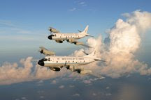
The second is the Lockheed WP-3D Orion, a four-engine, turboprop aircraft built expressly for NOAA in the mid-70s by the Lockheed California Co. of Burbank, CA. These rugged, powerful aircraft are derivatives of the famous Navy P-3s that were used for submarine hunting. They have served NOAA well for over 30 years in its hurricane activities as well as supporting
other environmental research programs.

The NOAA P-3s will be supporting several different hurricane projects this season. Operational support will be given to the National Hurricane Center (NHC) and the National Center for
Environmental Prediction (NCEP), both part of the NOAA National Weather Service (NWS). Typical of the types of tracks flown into hurricanes is what we call a Figure 4 pattern as shown here for Hurricane Felix 2007.

One of the primary efforts this summer will be directed at the collection of Tail Doppler Radar (TDR) data that can be used to derive horizontal wind fields in hurricanes. Such information as shown to the left for Hurricane Felix (courtesy J. Gamache, NOAA/HRD) can be transmitted via satellite to the NWS where scientists at the NCEP will ingest it into their computer models in an effort to improve intensity forecasts, currently a difficult task.
In addition to the operational missions for the NWS, the P-3s will also support the NOAA satellite service (NESDIS) with flights into regions of high winds and heavy precipitation as found in hurricanes. This project, called Ocean Winds, is primarily directed at collecting ground truth data for calibrating the QuickScat satellite - a very useful tool for obtaining ocean wind vectors (surface wind speed and direction) from space. And, these aircraft will also support scientists at NOAA's Hurricane Research Division in their attempts to better understand the life cycle of hurricanes.
Next: II. Aircraft Crews

No comments:
Post a Comment